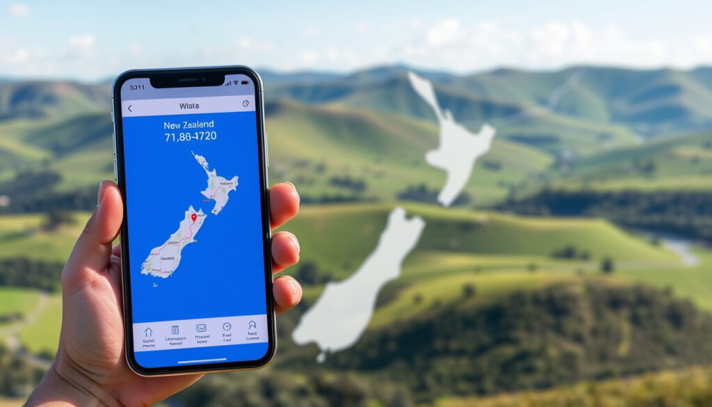
AA Distance Calculator NZ: Plan Drives with the AA Trip Tracker
Anyone who has sat down to plan a New Zealand road trip knows the first question isn’t where to go — it’s how far, and how long, the drive will take. The AA app’s Trip Tracker answers that in seconds by turning a start point, a destination, and a number plate into a distance, travel time, and cost estimate (AA Trip Tracker, the official AA tool). Here’s how to get the most out of it, and where it pays to double-check with another map.
Coastline of New Zealand: 15,134 km ·
Maximum driving distance (Cape Reinga to Bluff): ~2,100 km ·
AA membership in NZ: 1.6 million ·
Legal blood alcohol limit: 0.05% BAC ·
Default open road speed limit: 100 km/h
Quick snapshot
- The AA app includes Trip Tracker, a route planner with journey cost tracking (Google Play, Android app listing).
- Trip Tracker shows the shortest route only, with no alternatives or ferry segments included (AA Trip Tracker, the official AA tool).
- The trip summary appears once you enter the route, vehicle registration, and fuel or electricity choice.
- Download the AA app free from the App Store or Google Play to start planning.
Key facts
Six quick facts, one pattern: the AA’s route planner is an app-first experience, and the numbers it gives you are route estimates, not live traffic commitments.
| Field | Value |
|---|---|
| AA Calculator Availability | Web and mobile app |
| Cost to Use | Free for members; non-members limited |
| Distance Units | Kilometers |
| Fuel Cost Estimate | Based on average NZ fuel price |
| Route Optimization | Up to 3 stops per leg |
| Route Data | Shortest route via Google Maps; no ferries or alternatives |
Trip Tracker shows the shortest route, not the fastest — and it won’t include ferry legs. On the Cook Strait crossing, that can turn a 3-hour plan into a 5-hour reality.
Pair the AA estimate with Google Maps when you’re driving a busy corridor in Auckland or Wellington; the app’s own tool description doesn’t promise live traffic data.
Can I use the AA travel time and distance calculator in New Zealand?
Yes — the current version of the tool is called Trip Tracker and it lives inside the AA app. Enter a start and end destination, add your vehicle registration, choose fuel or electricity pricing, and the app returns a trip summary instantly (AA Trip Tracker, the official AA tool). The summary includes distance, estimated driving time, journey cost, fuel or energy usage, and CO2 emissions.
How to access the AA distance calculator online
- Download the AA app free from the App Store or Google Play.
- Open Trip Tracker from the app’s main menu.
- There is no separate desktop calculator; the tool is part of the mobile app.
Required information for a route query
- Start and end destinations — city, address, or landmark.
- Vehicle registration (number plate) so the app can link to vehicle data.
- Fuel or electricity pricing preference.
Understanding the results: distance, time, and cost estimates
- Distance in kilometres.
- Estimated driving time.
- Fuel or electricity cost estimate.
- CO2 emissions for the journey.
The pattern: AA has folded route planning into a mobile-first membership app rather than a standalone web tool. That makes it convenient on the road, but it also means a quick calculation requires an app download first.
Where can I find a driving distance calculator in New Zealand?
If you want a New Zealand-specific calculator, the AA app is the obvious starting point. Camping.org.nz, a NZ camping and road-travel guide, frames the AA travel and distance calculator as a journey-planning tool for estimating driving time between destinations (Camping.org.nz, NZ camping guidance).
Official AA route planner
- Trip Tracker inside the AA app gives distance, time, and cost in one pass.
- The tool uses a shortest-route model, not a fastest-route model.
Google Maps driving distance feature
- Free route planning with real-time traffic updates in most areas.
TripZilla, a New Zealand road-trip advice site, says the AA calculator works best when paired with Google Maps for estimating time (TripZilla, New Zealand road trip guide).
Third-party distance calculator websites
- Travel guides point back to the AA tool as the local NZ option (Camping.org.nz, NZ camping guidance).
- The Google Play listing shows the AA app bundles route planning with Roadservice, membership, and cost tracking (Google Play, Android app listing).
The trade-off: Google Maps is more flexible for custom routes and live traffic, but the AA tool adds New Zealand-specific journey cost and emissions data that a generic map won’t show.
How do I calculate the distance between two places from my location?
The AA Trip Tracker page confirms the basic flow: you type in a start and an end destination, then the app does the rest (AA Trip Tracker, the official AA tool). There is no “use current location” shortcut in the tool, so for a trip starting from where you are, your current suburb or nearest landmark becomes point A.
Using your current location as the starting point
- Open the AA app, enter your current address in point A.
- Add the destination in point B.
- Choose fuel or electricity pricing, then read the summary.
Entering a destination in the AA calculator
- Destination can be a city, address, or landmark.
Camping.org.nz notes the calculator can also help locate petrol stations and parking spaces and provide road closure and incident information (Camping.org.nz, NZ camping guidance). That makes it more than a distance finder when you’re in an unfamiliar region.
Getting directions from Google Maps on mobile
- Tap Directions, select your current location, and enter the destination.
TripZilla says the AA calculator can help account for heavy traffic, bad weather, toilet breaks, petrol station stops, and average-speed driving (TripZilla, New Zealand road trip guide). That’s the gap-filling role: use the AA number for cost and time, then switch to Google Maps for turn-by-turn directions.
The catch: the AA tool is a route and cost estimator, not a real-time navigation app. For traffic-aware turn-by-turn directions, you’ll still want Google Maps open while you drive.
What is the distance around New Zealand?
New Zealand’s coastline runs about 15,134 km, and the longest continuous drive from Cape Reinga to Bluff is roughly 2,100 km. Those two numbers frame the scale; they don’t mean the whole coastline is drivable, because many coastal areas are only accessible by foot or boat.
Driving the entire coastline: Cape Reinga to Bluff
- Maximum one-way road trip: about 2,100 km.
- Typical two-island round trip: 3 to 4 weeks.
AA route distances that show the real scale
- Official AA routes range from 119 km to 770 km.
Five AA routes, one pattern: the North Island’s longer highway loops are where the kilometres add up, while the South Island’s scenic strips are shorter but often slower.
| Route | Distance |
|---|---|
| Auckland to Dargaville via Whangārei and Cape Rēinga | 770 km |
| Thermal Explorer Highway: Auckland to Napier via Rotorua and Taupō | 453 km |
| Pacific Coast Highway: Gisborne to Ōpōtiki | 249 km |
| Southern Scenic Route: Bluff to Nugget Point | 193 km |
| Piopiotahi Highway: Te Anau to Milford Sound | 119 km |
Distances from the AA’s spring road-trip list (AA motoring blog, road-trip route list).
What this means: a “quick lap” of New Zealand is still a 2,100 km drive at best. The AA calculator gives you the per-leg number before you commit to the car.
What is the 4 second rule in NZ?
New Zealand’s official Road Code tells drivers to leave a two-second gap in good conditions, and to increase that to four seconds when the road is wet or visibility is poor. This matters on unfamiliar trips where the AA calculator gives you the distance but not the conditions.
When to use the 4-second rule
- Wet roads, rain, or spray from the vehicle ahead.
- Poor visibility, fog, or darkness.
- Unsealed or gravelled surfaces.
Penalties for not maintaining safe distance
- Fines and demerit points can apply under NZ’s graduated penalty system.
The AA app includes Road Code practice, which many drivers use to refresh these rules before a road trip (Google Play, Android app listing).
The implication: the four-second rule matters most exactly when the AA calculator is most useful — on a wet, unfamiliar road where the distance estimate is easy, but the driving time can stretch.
How to use the AA Trip Tracker step by step
The AA’s tool description and app listing line up as a clean six-step workflow.
- Download the AA app free from the App Store or Google Play.
- Open the app and select Trip Tracker.
- Enter the start point (point A).
- Enter the destination (point B).
- Add your vehicle registration and choose fuel or electricity pricing.
- Read the trip summary: distance, time, cost, fuel/energy use, and CO2 emissions.
The upshot: once the app is installed, the whole calculation takes under a minute — and it’s repeatable for every leg of a longer route.
Confirmed facts vs. what’s unclear
Confirmed facts
- AA New Zealand offers a travel time and distance calculator via Trip Tracker (AA Trip Tracker, the official AA tool).
- New Zealand’s coastline runs about 15,134 km.
- The legal blood alcohol limit for drivers over 20 is 0.05% BAC.
- The 4-second following rule is recommended in wet conditions.
What’s unclear
- Whether Trip Tracker accounts for real-time traffic or incident delays.
- Whether the tool includes road toll charges.
- How often AA’s membership and fuel-price figures are updated.
- Whether the shortest-route model matches the fastest route in practice.
What the sources say
“Trip Tracker gives you a view of journey costs, fuel or energy usage, and CO2 emissions for a route.”
AA Trip Tracker, official AA tool (AA Trip Tracker)
“The AA calculator can help locate petrol stations and parking spaces and provide information on road closures and incidents.”
Camping.org.nz, NZ camping guidance (Camping.org.nz)
“Use the AA calculator alongside Google Maps to estimate time needed on a New Zealand road trip.”
TripZilla, New Zealand road trip guide (TripZilla)
Summary
For New Zealand road trippers, the pattern is clear: the AA app handles the distance and cost estimate, Google Maps handles traffic and turn-by-turn reality, and the four-second rule handles the gap whenever the weather disagrees with the schedule.
Related reading
aa.co.nz, aa.co.nz, aa.co.nz, aa.co.nz, aa.co.nz, en.wikivoyage.org, blog.naver.com, frommers.com
Frequently asked questions
How accurate is the AA distance calculator?
Trip Tracker uses Google Maps to calculate the shortest route, so the distance is accurate for that route. It is a planning estimate, not a live traffic prediction.
Does the AA calculator include road closures or traffic?
Camping.org.nz notes the AA calculator can provide road closure and incident information. The AA Trip Tracker page itself focuses on shortest-route calculation, so for live conditions Google Maps is the safer check.
Is the AA distance calculator free for everyone?
The AA app is listed as free on Google Play. Some membership features live in the same app, but the trip-planning module is available to anyone who downloads it.
Can I use the AA calculator for walking or cycling distances?
No. Trip Tracker asks for vehicle registration and fuel or electricity pricing, so it is built for cars, hybrids, and EVs — not walking or cycling routes.
How do I plan a multi-stop route using the AA calculator?
Trip Tracker is a point-to-point tool. For multi-stop trips, map the full route in Google Maps first, then use the AA calculator for a cost estimate on each leg.
Does the AA calculator work offline?
Trip Tracker relies on Google Maps routing and current fuel data, so it needs an internet connection for fresh estimates.
More related posts
 APA 7th Referencing Generator – Best Free Tools 2025
 Canterbury Winter Snow Surfing: Surf and Ski Same Day Guide
 Best Vacuum Cleaner Reviews 2026: Top Picks & Buying Guide
 Dricus du Plessis vs Khamzat Chimaev: UFC 319 Result and Recap
 North West Medical Centre: Auckland GP & Urgent Care 8 AM-8 PM
 K9 Natural Dog Food Review: Is It Worth the Price
 When does spring start in NZ? Both dates explained
 Star Wars in Order: Release, Chronological & Machete Guide