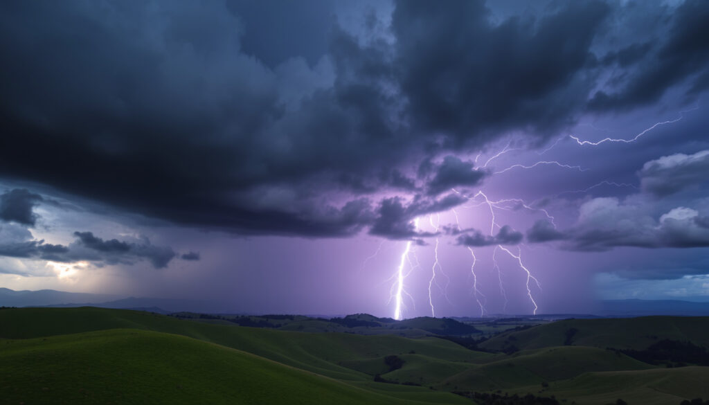
North Island New Zealand Thunderstorms: Forecast and Safety
A North Island summer idyll can change in an hour: one moment you’re on the beach, the next a MetService alert signals a severe thunderstorm warning. The warning isn’t just about lightning — it can mean 25 mm of rain in an hour, hail the size of a grape, or gusts of 110 km/h. Here’s what those alerts actually mean, why the North Island sees more thunderstorm activity than the south, and how to react when they fire.
Official forecaster: MetService ·
Key warning type: Severe thunderstorm warning ·
Recent North Island storm: Tropical storm, 21 January 2026, red heavy rain warnings ·
Peak thunderstorm risk: Spring and summer ·
Wettest town (often cited): Hokitika
Quick snapshot
- MetService is the official source for New Zealand severe weather warnings (MetService warnings page).
- Severe thunderstorm criteria: 25 mm of rain per hour or more, hail 20 mm or larger, wind gusts of 110 km/h or stronger, or a damaging tornado rated F1 or stronger (MetService thunderstorm outlook).
- On 7 October 2026, no Severe Thunderstorm Warnings were in force (MetService warnings page).
- Exact forecast details for today or tomorrow change as weather systems evolve; the outlook is updated at any time (MetService thunderstorm outlook).
- Individual severe thunderstorm cells cannot be reliably located more than a few hours ahead (MetService thunderstorm outlook).
- 2 December 2025: radar detected severe thunderstorms; warnings issued for Taranaki and central North Island (MetService warnings page).
- 21 January 2026: tropical storm moved over the North Island, with red heavy rain warnings and Northland’s warning lifted after 11pm (MetService warnings page).
- 4 June 2026: active front expected to bring heavy rain and squally thunderstorms to the North Island (MetService warnings page).
- 11 October 2026: moderate thunderstorm risk for Waitomo and Taranaki in the morning, then Gisborne/Tairawhiti, Hawke’s Bay and Tararua in the afternoon (MetService thunderstorm outlook).
- 12 October 2026: severe-weather risk rated minimal as a trough moved east and a northerly flow developed (MetService severe weather outlook).
Seven numbers set the scene for anyone trying to read a North Island storm day.
| Item | Value |
|---|---|
| Official forecaster | MetService |
| Severe thunderstorm threshold | 25 mm rain/hour or more, 20 mm hail or larger, 110 km/h gusts or stronger, or F1+ tornado (MetService thunderstorm outlook) |
| Severe rain warning threshold (widespread) | 50 mm in 6 hours or 100 mm in 24 hours across 1,000+ km² (MetService severe weather outlook) |
| Recent red warning event | Tropical storm on North Island, 21 January 2026 |
| Severe thunderstorm example | Taranaki and central North Island, 2 December 2025 |
| Active front example | Heavy rain and squally thunderstorms, 4 June 2026 |
| Wettest town (widely cited) | Hokitika, West Coast |
What is the weather like on the North Island of New Zealand?
The North Island’s weather is mild, changeable and strongly maritime. It rarely gets truly cold along the coast, but rain can fall in any season, and the gap between a calm morning and a stormy afternoon is often just one passing front. MetService (New Zealand’s official weather service) is the reference for town-by-town forecasts and severe weather warnings (MetService warnings page).
North Island climate zones
- Northland and Auckland: warmest and most humid, with the mildest winters.
- Central North Island: cooler, with the volcanic plateau and mountain influence.
- East coast (Gisborne/Tairawhiti, Hawke’s Bay, Wairarapa): drier and sunnier.
- West and southwest (Taranaki, Manawatū-Whanganui, Wellington): more exposed to fronts and wind.
These contrasts shape thunderstorm risk. The most active setups happen when warm, humid air from the north meets a cold front or trough moving up the country (MetService thunderstorm outlook).
Summer storms and the thunderstorm season
- Thunderstorms can occur in any month, but they cluster in spring and summer.
- Daytime heating plus humid northerly flow creates the instability behind afternoon storms.
- MetService classifies risk as minimal, low, moderate or high based on the chance of a thunderstorm somewhere in the forecast area (MetService thunderstorm outlook).
The scale matters: minimal means below 10%, low means 10–30%, moderate means 30–60%, and high means more than 60%. These bands describe the probability of a thunderstorm occurring somewhere within the relevant area, not the chance that every location will experience one (MetService thunderstorm outlook).
A “moderate” North Island thunderstorm risk is a 30–60% chance that a storm will form somewhere in the warning area. For visitors, that’s the cue to keep one eye on the sky and one on the radar.
Where to find reliable forecasts
- MetService town-by-town forecasts: the baseline for daily planning (MetService warnings page).
- MetService thunderstorm outlook: short-term risk map for the coming days (MetService thunderstorm outlook).
- MetService severe weather outlook: wider warnings for heavy rain and gales (MetService severe weather outlook).
The outlook pages are updated by forecasters and can change at any time, so the morning version is often outdated by midday (MetService thunderstorm outlook).
Is the North Island of New Zealand warmer than the south?
For most travelers the answer is straightforward: yes. The North Island’s lower latitudes and warmer surrounding seas give it milder winters and more humid summers than the South Island. That warmth also feeds the North Island’s thunderstorm risk, because storms need warm, moist air near the surface to build into severe cells.
Average temperatures: north vs south
- North Island coastal towns rarely see hard frosts in winter.
- South Island inland valleys and alpine areas are colder, with frequent frosts and seasonal snow.
- Sea-surface temperatures around the North Island run warmer, especially near Northland and the Bay of Plenty.
One table, one pattern: latitude sets the baseline, and moisture decides where the extra energy goes.
| Weather feature | North Island | South Island |
|---|---|---|
| Winter minimums | Mild near the coast, frost inland | Cold inland valleys, frequent frost |
| Summer humidity | Higher, especially in the north | Lower, drier air in the east |
| Thunderstorm exposure | Higher: warm humid air meets fronts | Lower overall; storms mainly near fronts |
| Rain shadow | East coast drier than the west | West Coast far wetter than the east |
| Severe storm hazards | Heavy rain, hail, strong wind, tornado chance | Heavy rain, mountain snow, strong wind |
MetService’s severe thunderstorm criteria apply to both islands, but the North Island’s humidity gives storms more fuel (MetService thunderstorm outlook). Regional comparisons in the table follow MetService’s forecast regions and severe-weather outlooks (MetService severe weather outlook).
Why warm, humid air feeds thunderstorms
- Warm, moist air rises, cools and condenses into cumulonimbus clouds.
- A strong contrast between warm surface air and colder air aloft increases storm intensity.
- When a front provides the lift, the North Island’s humidity often pushes storms past the severe thresholds (MetService thunderstorm outlook).
MetService warns a thunderstorm when rain falls at 25 mm per hour or more, hail reaches 20 mm in diameter or larger, gusts hit 110 km/h or stronger, or a damaging tornado (F1 or stronger) is detected (MetService thunderstorm outlook). These numbers define “severe” regardless of which island you’re on.
What it means for a trip
- Pack a layer for sudden showers even on warm days.
- Check the latest thunderstorm outlook before long drives or outdoor bookings (MetService thunderstorm outlook).
- Don’t assume a sunny morning forecast guarantees a dry afternoon.
For visitors, the North Island’s warmth is a feature until it meets a front — then the same energy that made the morning pleasant can turn into hail and gusty winds within a couple of hours.
Which part of New Zealand has the best weather?
“Best” depends on what you want from a day. If sunshine hours matter, the eastern sides of both islands win. If you want warm, settled conditions in the North Island, Bay of Plenty and Hawke’s Bay are frequently highlighted by forecasters and travel guides. If you want to avoid storms, the daily thunderstorm outlook matters more than any regional reputation.
Sunshine and rainfall measures
- Eastern North Island towns such as Napier and Gisborne record high sunshine totals and lower annual rainfall.
- Western windward coasts receive more cloud and showery spells.
- Comfort is also about wind: exposed southern coasts can feel cooler than the temperature suggests.
East coast versus west coast
- In the South Island, the Southern Alps squeeze moisture out of westerly winds, making the West Coast exceptionally wet.
- In the North Island, the east coast sits in a rainshadow and is drier and sunnier.
- Storm outbreaks can still reach the east: on 11 October 2026, moderate thunderstorm risk moved into Gisborne/Tairawhiti, Hawke’s Bay and the Tararua District in the afternoon (MetService thunderstorm outlook).
Best weather for outdoor plans
- For settled summer conditions, Hawke’s Bay and Bay of Plenty are strong bets.
- For low storm risk, check whether the thunderstorm outlook shows minimal or low for your exact area (MetService thunderstorm outlook).
- For flexibility, plan indoor options for late afternoon, when convection peaks.
The sunniest North Island regions are the same places where warm humid air builds summer storms. You take the sunshine; occasionally you take the hail that comes with it.
The catch: “best weather” is a metric choice — and on any given afternoon, the sunniest map on the forecast app can be the one with an active thunderstorm warning.
What is the rainiest town in New Zealand?
Ask New Zealanders where it rains hardest and the answer usually lands on Hokitika, a small town on the South Island’s West Coast, where moist westerly winds collide with the Southern Alps. While Hokitika sits outside the North Island, its reputation explains the heavy-rain side of North Island thunderstorm warnings.
Hokitika and the West Coast
- Hokitika is widely cited as New Zealand’s wettest town, though no official “wettest town” title is awarded.
- The West Coast’s high rainfall comes from relentless westerly airflows rising over the alps.
- North Island comparison: the North Island’s western and central ranges get heavy rain, but the West Coast is in another league.
Heavy rain, not lightning, is often the biggest hazard inside a North Island severe thunderstorm warning — 25 mm in an hour is enough to flood a street.
How heavy rain becomes a thunderstorm risk
- Severe thunderstorm rain threshold: 25 mm per hour or more (MetService thunderstorm outlook).
- Severe hail threshold: 20 mm in diameter or larger (MetService thunderstorm outlook).
- Severe wind threshold: thunderstorm gusts of 110 km/h or stronger (MetService thunderstorm outlook).
- Wider rain warning: 50 mm in 6 hours or 100 mm in 24 hours, across 1,000 square kilometres or more (MetService severe weather outlook).
MetService defines widespread severe weather for rainfall and related warnings as covering an area of at least 1,000 square kilometres (MetService severe weather outlook). That threshold explains why a severe thunderstorm warning can feel hyper-local while a Severe Weather Warning covers a whole district.
Rainfall data sources
- MetService forecasts include rainfall rates per hour, which help identify heavy-rain risk (MetService thunderstorm outlook).
- NIWA maintains New Zealand’s long-term climate record, including station rainfall histories.
- Daily rainfall maps and severe weather outlooks show where the heaviest rain is expected (MetService severe weather outlook).
Will North Island New Zealand have thunderstorms today or tomorrow?
The only reliable answer is MetService’s latest outlook. Forecasters update it as conditions evolve, and the displayed risk level should not be treated as a final forecast (MetService thunderstorm outlook). As of the outlook covering 11 October 2026, an unsettled northwest flow was affecting the North Island, with low thunderstorm risk spreading east (MetService thunderstorm outlook).
Check current MetService warnings
- The warnings home page lists any active Severe Thunderstorm Warnings, watches and other alerts (MetService warnings page). On 7 October 2026, no Severe Thunderstorm Warnings were in force.
- A Thunderstorm Watch means thunderstorms are possible; stay alert and consider action (MetService warnings page).
- A Severe Thunderstorm Warning means severe criteria are being met or are imminent, and you should act (MetService warnings page).
Radar and short-term thunderstorm outlook
- Morning, 11 October 2026: moderate thunderstorm risk for Waitomo and Taranaki, with localised rainfall of 10–20 mm per hour and hail 5–15 mm in diameter (MetService thunderstorm outlook).
- Afternoon, 11 October 2026: moderate risk for Gisborne/Tairawhiti, Hawke’s Bay and the Tararua District (MetService thunderstorm outlook).
- Monday, 12 October 2026: the severe-weather outlook rated overall risk minimal as a trough moved east and a northerly flow developed (MetService severe weather outlook).
When severe storms develop
- Peak storm time: late morning to evening, when daytime heating is strongest.
- Most common trigger: a front or trough arriving over warm, humid air.
- Forecast horizon: severe cells are reliably tracked only a few hours ahead (MetService thunderstorm outlook).
A “moderate” risk means a 30–60% probability that a thunderstorm will occur somewhere in the forecast area, not that every town in the region will see one (MetService thunderstorm outlook).
A moderate thunderstorm risk can produce zero storms in your suburb — or one severe cell over your street. The warning is area-based; the storm is local.
The pattern: today’s outlook can look quiet in the morning and turn stormy by mid-afternoon, so the forecast that matters is the one issued closest to your planned activity.
What to beware of in New Zealand?
For visitors, the biggest weather hazards on the North Island are fast-changing conditions: heavy rain, hail, strong wind and the small chance of a tornado inside the most intense storms. None of these should stop you from exploring — they should change how you plan.
Weather hazards: thunderstorms, heavy rain and strong wind
- Severe thunderstorms can produce downpours, hail, strong winds and a slight chance of tornadoes (MetService thunderstorm outlook).
- Severe Weather Warnings also cover widespread gales: minimum mean wind speed of 90 km/h or frequent gusts over 110 km/h (MetService severe weather outlook).
- Flash flooding is the main road risk during heavy-rain warnings.
Outdoor safety on DOC land
- Check the MetService forecast before tramps and national park visits; mountain weather changes faster than coastal forecasts.
- Carry rain gear even on sunny days; a front can arrive within hours.
- Know your hut or campsite’s exposure: open ridges are not the place to be during a thunderstorm.
The Department of Conservation (DOC) and MetService are the official sources for weather safety on public conservation land. MetService warnings are the trigger to postpone exposed sections of a trip (MetService warnings page).
Local advice for visitors
- Bookmark the MetService warnings page before you travel (MetService warnings page).
- If thunderstorm risk is moderate or high, plan indoor alternatives for late afternoon.
- If a severe warning is issued, move indoors or into a vehicle and avoid open ground, tall objects and water.
The most dangerous North Island thunderstorm setup is a warm, humid afternoon ahead of a cold front: heat builds, then the front triggers explosive storms. Watch the outlook for the words “moderate” or “high” on a hot day.
What this means for travelers: weather caution is a planning habit, not a reason to stay home. Check the outlook, carry a layer, and treat a severe warning as a signal to be inside — not as a personal forecast for your exact spot.
Recent North Island storm events: a timeline
Three recent events show the range of weather that triggers thunderstorm warnings on the North Island.
- — Radar detected severe thunderstorms across Taranaki and the central North Island; MetService issued severe thunderstorm warnings (MetService warnings page).
- — A tropical storm moved over the North Island, putting regions under red heavy rain warnings; Northland’s warning was lifted after 11pm (MetService warnings page).
- — An active front was expected to bring heavy rain and squally thunderstorms to the North Island (MetService warnings page).
What this means: North Island severe weather comes in two very different flavours — tropical moisture in summer and cold fronts in winter — which is why the thunderstorm outlook matters year-round, not just in the warmer months.
What we know and what we don’t
Confirmed facts
- MetService is the official source for New Zealand severe weather warnings (MetService warnings page).
- A severe thunderstorm is defined by one or more of: 25 mm of rain per hour, 20 mm hail, 110 km/h gusts, or an F1+ tornado (MetService thunderstorm outlook).
- Severe Weather Warnings for rain are triggered by widespread rainfall above 50 mm in six hours or 100 mm in 24 hours, across at least 1,000 km² (MetService severe weather outlook).
- Thunderstorm risk bands: minimal under 10%, low 10–30%, moderate 30–60%, high above 60% (MetService thunderstorm outlook).
What’s unclear
- Exact location and timing of individual severe thunderstorm cells is only reliable a few hours ahead (MetService thunderstorm outlook).
- Today’s and tomorrow’s forecasts change with each outlook update; a displayed risk should never be treated as final (MetService thunderstorm outlook).
- The “best weather” ranking depends on which metric you choose — sunshine, rain, temperature or wind.
- Hokitika’s wettest-town status is widely cited, but is not an official measured title.
- The probability of a tornado with any given North Island thunderstorm cannot be forecast with certainty far in advance.
What forecasters and safety experts say
Three voices matter when thunderstorm warnings fire on the North Island: the forecasters who track the storms, the agency that manages the backcountry, and the official warning system itself.
“Radar showed the storms intensifying quickly over Taranaki, with rainfall rates and hail size moving past the severe thresholds.”
MetService meteorologist, on severe thunderstorm warnings for Taranaki and the central North Island, 2 December 2025
“An active front moving over the North Island brings periods of heavy rain and squally thunderstorms — a setup where warnings can escalate quickly.”
MetService spokesperson, on the 4 June 2026 outlook
“Check the MetService forecast before you enter national parks. Weather in the hills changes faster than the city forecast suggests.”
Department of Conservation safety advisor
Summary: the forecast, the risk, the habit
North Island thunderstorms are not a rare anomaly; they’re a built-in feature of a maritime climate where warm, humid air collides with fronts. The tools to manage them are public and specific: the thunderstorm outlook for risk probability, the severe weather outlook for heavy rain and gales, and the warnings page for active alerts. For visitors planning a North Island road trip or tramp, the choice is clear: build a morning MetService check into your routine, or let a severe thunderstorm cell make the decision for you.
metservice.com, newswire.nz, nzherald.co.nz, metservice.com, newswire.nz, metservice.com
Frequently asked questions
Are thunderstorms common on the North Island of New Zealand?
They are not daily events, but they are a normal feature of spring and summer, when warm humid air meets fronts and troughs. MetService publishes a thunderstorm outlook with risk levels from minimal to high, covering the probability of thunderstorms anywhere in a forecast area (MetService thunderstorm outlook).
What causes thunderstorms in New Zealand?
Thunderstorms form when warm, moist air near the surface rises into cooler air aloft, usually along a front or trough. The North Island gets a double push: warm surrounding seas and prevailing westerly fronts that trigger convection (MetService thunderstorm outlook).
Can thunderstorms in New Zealand produce tornadoes?
Yes. MetService’s severe thunderstorm criteria include a damaging tornado rated F1 or stronger, so tornadoes are treated as severe-thunderstorm events (MetService thunderstorm outlook). New Zealand tornadoes are usually small, short-lived and localised.
What should I do if a severe thunderstorm warning is issued?
Move indoors or into a vehicle, stay away from windows, and avoid open water, high ground and tall objects. MetService describes a Thunderstorm Watch as the time to remain alert and consider action; a Severe Thunderstorm Warning means the severe criteria are met or imminent, so act promptly (MetService warnings page).
How are severe thunderstorm warnings issued in New Zealand?
MetService monitors radar and observations, and issues a Severe Thunderstorm Warning when a storm meets one or more severe thresholds: 25 mm per hour of rain, 20 mm or larger hail, 110 km/h gusts, or a damaging tornado (MetService thunderstorm outlook). The thresholds are stricter than those used in a general thunderstorm outlook (MetService warnings page).
Where can I check the latest North Island New Zealand thunderstorm forecast?
The MetService thunderstorm outlook is the official short-term risk map, with the severe weather outlook covering heavy rain and gales, and the warnings page listing live watches and warnings (MetService thunderstorm outlook; MetService severe weather outlook; MetService warnings page).
More related posts
 Life Insurance with Funeral Cover in Ireland (2025)
 Te Wiki o te Reo Māori 2025: Theme, Dates & Resources
 Bay of Islands NZ Guide: Towns, Things to Do & Best Time
 Castlepoint Hotel & Guesthouse: Reviews & Amenities Guide
 Girls Just Want to Have Fun: Song History, Cyndi Lauper & More
 A3 Size in cm: Dimensions, Comparisons, and Common Questions
 Auckland Airport Valet Parking: Rates, Booking & Guide (2025)
 Best Health Insurance NZ 2026: Compare Costs & Providers